Jul Roldán-Guevara, Eduardo A. Rossello
2 022
Boletín de Geología, vol. 44, n.° 3, septiembre-diciembre de 2022
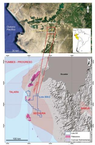
La perforación del pozo hidrogeológico Alejandrina a los 209 m bbp, muy por debajo de la profundidad habitual de los pozos de agua de la zona, alcanzó un nivel areniscoso de la Formación Zapallal con contenido gasífero inesperado que determinó un fuerte venteo, licuefacción de la plataforma de perforación, colapso del equipo de perforación y la contaminación de los niveles tradicionalmente productores del acuífero confinado. Para mitigar esta invasión de gas y surgencia a superficie, se perforaron los pozos: i) de alivio Papayal, para efectuar maniobras de captura y cementación donde se requirieron 5 intentos de perforación direccional hasta interceptar el pozo Alejandrina y ii) exploratorio Curumuy 1X para disminuir la presión de la invasión de gas y conocer sus posibles orígenes anormales a esas profundidades tan someras. El objetivo del trabajo es informar la estratigrafía de este sector potencialmente exploratorio con probada presencia de recursos de gas de la cuenca Sechura y describir la secuencia de acontecimientos de la interferencia en el manejo y producción entre los recursos hidrogeológicos y gasíferos que comparten los mismos reservorios areniscosos de la Formación Zapallal. Para ello, se aportan datos petrofísicos a partir de los registros de perforación de los pozos Alejandrina, Papayal y Curumuy 1X y un modelo simulado de carga y manejo del gas responsable de la contaminación. De esta manera, se presenta un caso de interferencia de objetivos del subsuelo con la intención de preservar y restablecer el comportamiento de los pozos productores del acuífero y a la vez producir gas.
The drilling of the Alejandrina hydrogeological well at 209 m bbp, below the usual depth of water wells in the area, reached a sandy level of the Zapallal Formation with unexpected gas content that caused strong blow-up, venting, liquefaction of the ground, collapse of the drilling equipment and contamination of the traditionally producing levels of the confined aquifer. To mitigate this invasion of gas and it upwelling to the surface, the following wells were drilled: i) Papayal interference well, to carry out capture and cementing maneuvers with 5 horizontal attempts until intercepting the Alejandrina well, and ii) Curumuy 1X exploratory well to reduce the pressure of the gas invasion and discover its possible abnormal origins at such shallow depths. The objective of the work is to present the stratigraphy of this potentially exploratory sector with proved gas resources of the Sechura basin and to describe the sequence of events of the interference in the management and relationships between the hydrogeological and gas resources that share the same sandstone reservoirs of the Zapallal Formation. For this, petrophysical data are provided from the drilling records of the Alejandrina, Papayal and Curumuy 1X wells and a simulated model of loading and handling of the gas responsible for the contamination. In this way, a case of interference of different subsoil objectives is presented with the intention of preserving and reestablishing the behavior of the producing wells of the aquifer and at the same time producing gas.

