Tesis Doctoral
Autor: Leandro César Gallo
Año: 2019
Directora: Dra. Renata Nela Tomezzoli
Codirectora: Alejandra Dalenz Farjat
Resumen

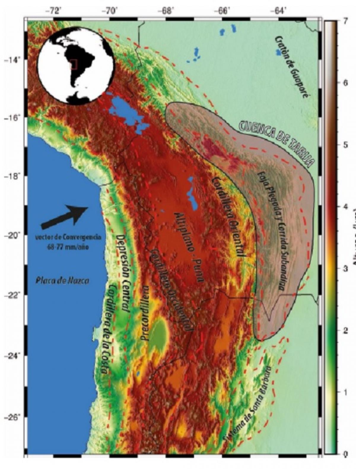
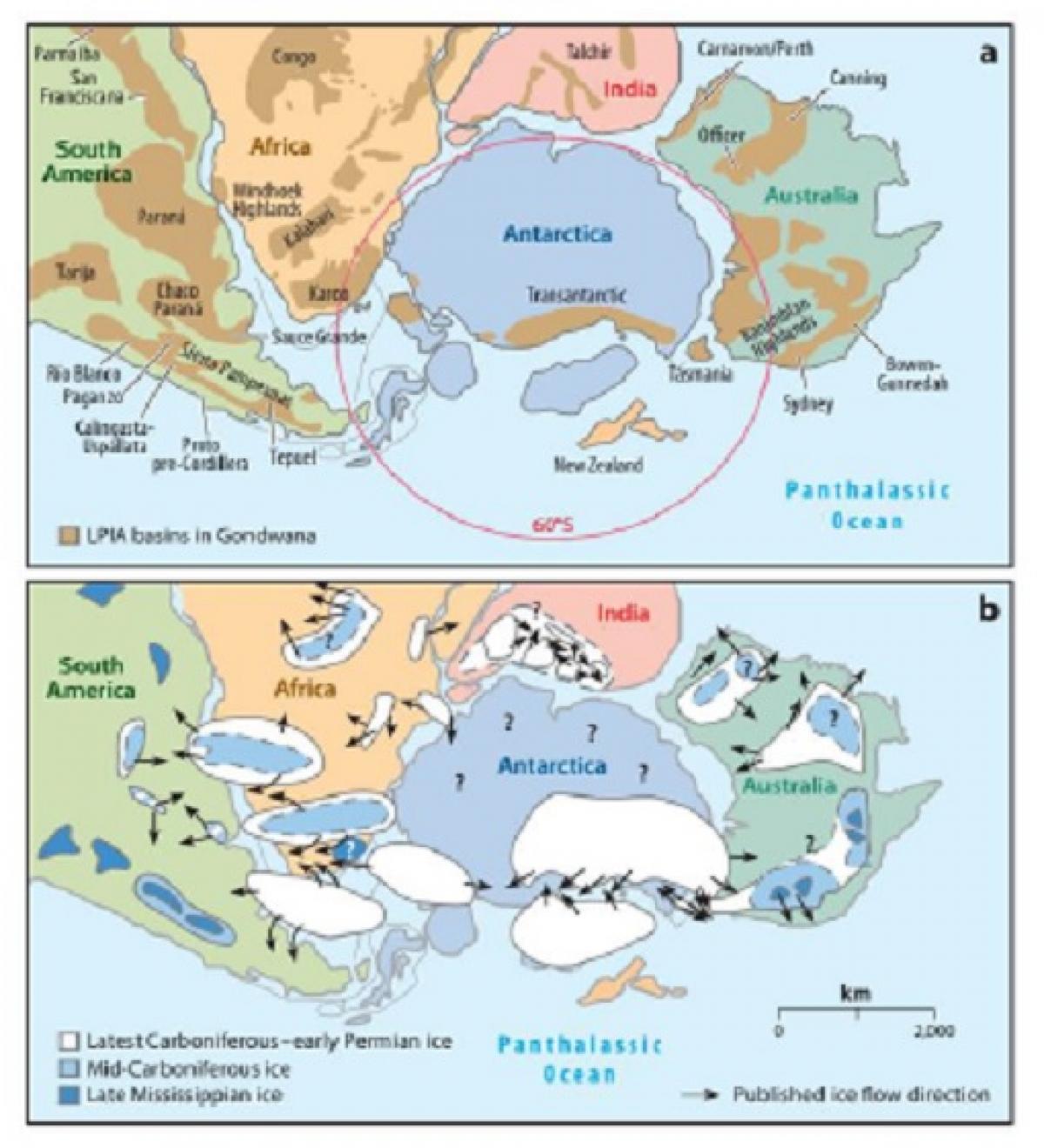
Durante más de 50 años de investigación, la base de datos paleomagnética se ha vuelto mucho más abundante y confiable. Sin embargo, al día de hoy persisten dudas respecto de la Curva de Deriva Polar Aparente (CDPA) de Gondwana para el Paleozoico tardío y, por lo tanto, de la paleogeografía asociada. La Pangea clásica de Wegener es la configuración convencional de los continentes antes del comienzo de la expansión del océano Atlántico durante el Jurásico Temprano. Sin embargo, las paleoreconstrucciones previas, que incluyen el proceso de amalgamamiento de Pangea, continúan sujetas a debate. El foco de la discusión se centra en la capacidad de la remanencia magnética de registrar de manera correcta la inclinación del campo paleomagnético. Aquí se implementó un método novedoso para el cálculo de la CDPA de Gondwana, evitando el uso de la inclinación paleomagnética mediante el método de intersección de círculos máximos que contienen el paleopolo y su sitio de muestreo. Esto purifica el análisis de errores de inclinación en rocas sedimentarias, contribuciones no dipolares y evita la necesidad de aplicar correcciones teóricas. Adicionalmente, y debido al sesgo inherente que existe en la intersección de círculos máximos, mediante simulaciones numéricas se propusieron reglas para la evaluación empírica del sesgo, con el objetivo de añadirle reproducibilidad al método. Se realizaron estudios paleomagnéticos en los Grupos Macharetí, Mandiyutí, y Cuevo, aflorantes en tres perfiles en Bolivia meridional con el objetivo de aportar información al entendimiento de la cronoestratigrafía del Paleozoico tardío de la Cuenca. Asimismo, los datos paleomagnéticos fueron utilizados para realizar un análisis de paleolatitudes como función de tiempo. Se realizó el análisis de facies de los Grupos Mandiyutí y Cuevo de donde se desprende una impronta glaciar en las unidades carboníferas de la Cuenca de Tarija, que hacia el Pérmico cambian a sedimentación de ambientes desérticos y cálidos. Estas unidades registran la misma transición icehouse-greenhouse que otras cuencas paleozoicas de Gondwana occidental y proveen un punto de control clave de la evolución climática durante la formación de Pangea.Al combinar el análisis paleolatitudinal, a partir de los datos paleomagnéticos, con la interpretación paleoclimática, se observa que el cambio marcado de facies sedimentarias concuerda con una deriva continental brusca de la cuenca hacia latitudes más bajas. La información paleoclimática interpretada es congruente tanto con los datos paleomagnéticos, cómo con la paleolatitud obtenida a partir de la CDPA propuesta para Gondwana. De esta manera, dos métodos proveen de manera independiente la evolución paleolatitudinal de la Cuenca de Tarija. En consecuencia, se argumenta que la deriva continental marcada de Gondwana hacia latitudes bajas ejerce un control de primer orden en el cambio paleoclimático abrupto ocurrido entre el Carbonífero superior y el Pérmico inferior de la Cuenca de Tarija.La posición de Gondwana para el Pérmico temprano conduce a un arreglo paleogeográfico que difiere de la clásica Pangea de Wegener para el Carbonífero tardío y Pérmico temprano. Es necesario desplazar Laurusia hacia el oeste en un arreglo de tipo ?Pangea B? durante el Carbonífero superior que luego evoluciona, durante el Pérmico inferior, hacia la Pangea de Wegener aceptada para el Pérmico superior.
Abstract

In over 50 years of paleomagnetic research, the available paleomagnetic pole determinations have become much more abundant and reliable. However, doubts persist regarding the Gondwana Apparent Polar Wander Path (APWP) for the upper Paleozoic and, therefore, to the associated paleogeography. The Wegener’s classic Pangea, also known as A-type Pangea, is the conventional plate reconstruction before its breakup in the Early Jurassic prior to the opening of the North Atlantic. Nonetheless, previous paleogeographies, including the process of amalgamation of Pangea, has been a subject of debate for the past 50 years. This 50-year-old debate focuses specifically on magnetic remanence and its ability to correctly record the inclination of the paleomagnetic field. Here, a selection of paleopoles was made to find the great circles containing the paleomagnetic pole and the respective sampling site. The true dipole pole (TDP) was then calculated by intersecting these great circles, effectively avoiding nondipolar contributions and inclination shallowing, in an innovative method. Then, the paleogeographic implications of doing so are analyzed for the process of amalgamation of Pangea. Additionally, due to the inherent bias that exists at the intersection of maximum circles, numerical simulations propose rules of thumb for the empirical evaluation of bias with the objective of adding reproducibility to the method. Paleomagnetic studies were carried out in the Macharetí, Mandiyutí and Cuevo Groups, outcropping in three profiles of southern Bolivia. The aim was to provide information on the understanding of the chronostratigraphy of the basin. Also, the paleomagnetic data was utilized to perform a paleolatitudinal analysis as a function of time. The sedimentology of the Mandiyutí and Cuevo Groups was analyzed and suggest a glacial imprint in the Carboniferous units of the Tarija Basin which towards the Permian change to sedimentation of desert and warm environments. When combining the paleolatitudinal analysis derived from the paleomagnetic data with the paleoclimatic interpretation, it is observed that the change in sedimentation agrees with a pronounced continental drift towards lower latitudes. The paleoclimatic information is congruent with both paleomagnetic data and paleolatitudes derived from the proposed APWP for Gondwana. Hence, two independent methods provide the paleolatitudinal evolution of the Tarija Basin. As a consequence, it is argued that the marked continental drift experimented by Gondwana towards lower latitudes exerts a first order control on the abrupt paleoclimatic change occurred between the upper Carboniferous and the lower Permian of the Tarija Basin. The interpreted position for Gondwana leads to a Pangea configuration that differs from Wegener’s Pangea for the upper Carboniferous and early Permian. The analysis makes it necessary to slide Laurrussia to the west in relation to Gondwana in a B-type Pangea during the Upper Carboniferous, later evolving, during the Early Permian, to reach the final A-type Pangea configuration of the Upper Permian.
