Franck Eitel Kemgang Ghomsi, Luan Thanh Pham, Robert Tenzer, Federico D.
Esteban, Tich Van Vu & Joseph Kamguia
Esteban, Tich Van Vu & Joseph Kamguia
2 022
Geocarto International Volume 37, 2022 - Issue 25
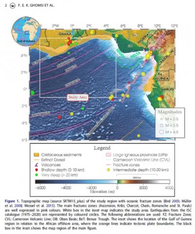
Satellite gravity datasets have been widely used in understanding of the Earth's internal structure and processes. These datasets are effective in providing insights into the lithospheric structure of the Earth. Gravity data from the satellite products CryoSat-2 and Jason-1 have been used to investigate the Gulf of Guinea sedimentary basins and structural lineaments in this under-explored marginal sea region through the application of various edge filters. Present-day filtering methods such as the analytical signal, tilt angle of the gradient amplitude, NTilt gradient amplitude and softsign function were evaluated for their performance on synthetic gravity anomalies with and without noise prior to their application to gravity data covering the Gulf of Guinea. The softsign filter outputs obtained from synthetic examples result in higher resolution and more explicit edges while preventing fictitious edges production in the findings. The results of the data interpretation disclosed deep-seated and shallow structural features within the Gulf of Guinea oriented mainly in the WNW-ESE, NW-SE, NE-SW and NNE-SSW directions and seen to be concentrated in the upper slope domain. This observation is in good agreement with the occurrence of drag folds and the apparent concentration of wrench faulting features across the ridge top and bordering the upper slope. These results bring new facts ruling our understanding of this atypical regional tectonic setting in close agreement with the NE–SW-striking Pelusium Megashear Zone.

